किपा:LocationRomanEmpire.png
Size of this preview: ८०० × ५२० pixels. Other resolutions: ३२० × २०८ pixels | ६४० × ४१६ pixels | १,०८४ × ७०५ pixels.
Original file (१,०८४ × ७०५ pixels, file size: ३४ KB, MIME type: image/png)

|
File:Map of the Roman Empire at its height.svg is a vector version of this file. It should be used in place of this PNG file when not inferior.
File:LocationRomanEmpire.png → File:Map of the Roman Empire at its height.svg
For more information, see Help:SVG. |
 |
| Description |
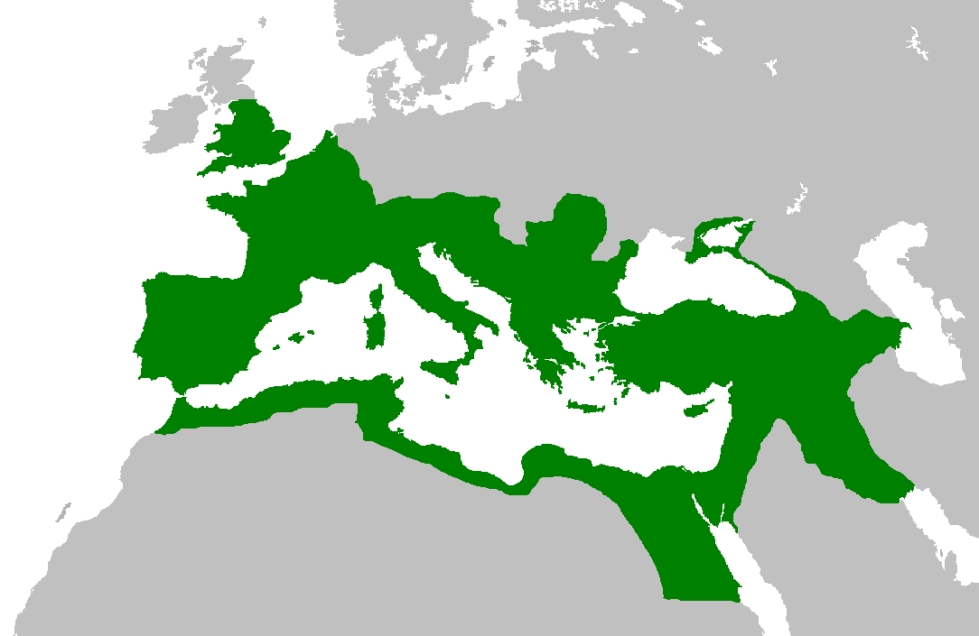
English: Map of the Roman Empire at its height, under Trajan.
Esperanto: Mapo de la Roma Imperio je ĝia plej vasta etendo, sub la imperiestro Trajano.
Español: El Imperio Romano a su máxima extensión, durante el reinado de Trajano.
Suomi: Rooman valtakunta Trajanuksen aikana.
Français : L'Empire romain à son apogée, sous Trajan.
Italiano: Mappa dell'Impero Romano al culmine della sua estensione, sotto Traiano.
日本語: 117年(トラヤヌス帝の時代)のローマ帝国の最大領土
Português: Localização do Império Romano em sua extensão máxima. |
||||||||
| Date | |||||||||
| Source | Previous version | ||||||||
| Author | User:Jrockley / User:Kasper Holl | ||||||||
| Permission (Reusing this file) |
|
||||||||
| Other versions |
|

File history
Click on a date/time to view the file as it appeared at that time.
| Date/Time | Thumbnail | Dimensions | छ्य्लामि | Comment | |
|---|---|---|---|---|---|
| current | १४:४४, २ जुन २००७ | | १,०८४ × ७०५ (३४ KB) | Medievalista | Ok, sorry, my mistake... here is the new map |
| १४:४२, २ जुन २००७ |  | १,०८४ × ७०५ (३४ KB) | Medievalista | Update of the previous map: less of teritory in Africa, withdraw in Britain up to the future Hadrianic wall and improve the trace of the Rhine-Danube frontier | |
| ०३:४५, ५ फेब्रुवरी २००७ |  | १,०८४ × ७०५ (३५ KB) | Jrockley | lil bit more Africa, lil less Scandinavia | |
| ०३:२८, ५ फेब्रुवरी २००७ |  | १,२५९ × ७५६ (४१ KB) | Jrockley | Much larger version, as faithful as possible | |
| १२:२४, ९ अगस्ट २००५ |  | २५० × १७५ (८ KB) | Kasper Holl | Map of the location of the Roman Empire at its height, under Trajan. Made from the Blank Map World. |
File usage
There are no pages that use this file.
Global file usage
The following other wikis use this file:
- Usage on en.wikipedia.org
- Usage on he.wikipedia.org
- Usage on hy.wikipedia.org
- Usage on it.wikipedia.org
- Usage on kk.wikipedia.org