किपा:Map of Illinois highlighting LaSalle County.svg

Size of this PNG preview of this SVG file: ३३६ × ५९९ pixels. Other resolutions: १३४ × २४० pixels | २६९ × ४८० pixels | ४३० × ७६८ pixels | ५७४ × १,०२४ pixels | १,१४८ × २,०४८ pixels | ३,४५३ × ६,१५७ pixels.
Original file (SVG file, nominally ३,४५३ × ६,१५७ pixels, file size: ८५ KB)
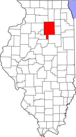
This is a locator map showing LaSalle County in Illinois.
David Benbennick made this map. For more information, see Commons:United States county locator maps.
| I, the copyright holder of this work, release this work into the public domain. This applies worldwide. In some countries this may not be legally possible; if so: I grant anyone the right to use this work for any purpose, without any conditions, unless such conditions are required by law. |
File history
Click on a date/time to view the file as it appeared at that time.
| Date/Time | Thumbnail | Dimensions | छ्य्लामि | Comment | |
|---|---|---|---|---|---|
| current | १३:२६, ५ अप्रिल २००७ | | ३,४५३ × ६,१५७ (८५ KB) | Ruhrfisch | This is a locator map showing La Salle County in Illinois. David Benbennick made this map. For more information, see Commons:United States county locator maps. {{PD-self}} [[Category:La Salle Count |
File usage
The following page uses this file:
Global file usage
The following other wikis use this file:
- Usage on ar.wikipedia.org
- مقاطعة لاسال (إلينوي)
- نورث يوتيكا (إلينوي)
- دالزل (إلينوي)
- كانغلي (إلينوي)
- ليونوري (إلينوي)
- نابلت (إلينوي)
- سينيسا (إلينوي)
- تروي غروف (إلينوي)
- سيدار بوينت (إلينوي)
- دانا (إلينوي)
- غراند ريدج (إلينوي)
- ليلاند (إلينوي)
- لوستانت (إلينوي)
- أوتاوا (إلينوي)
- سترتور
- بيرو (إلينوي)
- لاسال
- مرسيليا (إلينوي)
- إيرلفيل
- ميندوتا
- أوغلسبي
- وينونا
- ميلينغتون (إلينوي)
- رانسوم (إلينوي)
- روتلاند (إلينوي)
- شريدان (إلينوي)
- سوموناك (إلينوي)
- تونيكا (إلينوي)
- قالب:مقاطعة لاسال (إلينوي)
- Usage on bg.wikipedia.org
- Usage on ca.wikipedia.org
- Llista de comtats d'Illinois
- Cedar Point (Illinois)
- Dalzell (Illinois)
- Dana (Illinois)
- Earlville (Illinois)
- Grand Ridge (Illinois)
- Kangley
- La Salle (Illinois)
- Leland (Illinois)
- Leonore (Illinois)
- Lostant
- Marseilles (Illinois)
- Mendota (Illinois)
- Millington (Illinois)
- Naplate
- North Utica
- Oglesby (Illinois)
- Ottawa (Illinois)
View more global usage of this file.