किपा:LocationByzantineEmpire.png
Size of this preview: ८०० × ५२० pixels. Other resolutions: ३२० × २०८ pixels | ६४० × ४१६ pixels | १,०८४ × ७०५ pixels.
Original file (१,०८४ × ७०५ pixels, file size: २९ KB, MIME type: image/png)
Summary
| Description |
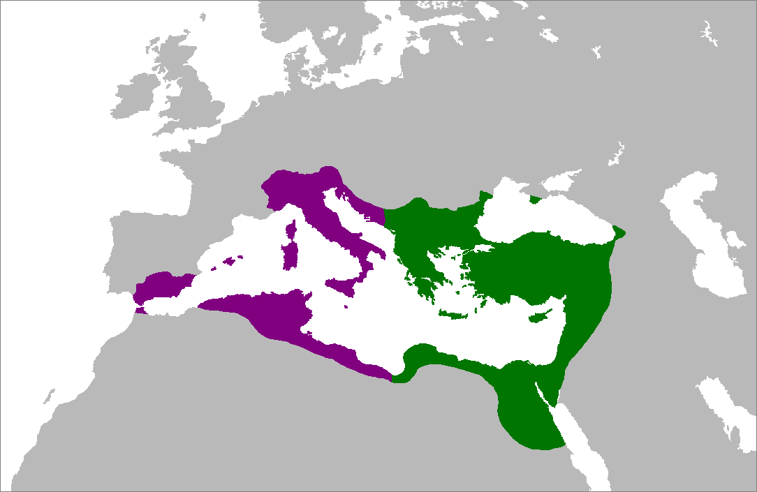
English: Map of the Byzantine Empire at its greatest extent in the 6th century. Territories in purple were reconquered during the reign of Justinian I.
العربية: خريطة الإمبراطورية البيزنطية في أقصى امتداد لها في القرن السادس. تمت السيطرة على الأراضي باللون الأرجواني في عهد جستنيان الأول. |
|||
| Date | ||||
| Source | Own work (Original text: Self-made from Image:LocationRomanEmpire.png; borders based on a map from http://www.bartleby.com/.) | |||
| Author | Zakuragi | |||
| Other versions |
|


Licensing

|
Permission is granted to copy, distribute and/or modify this document under the terms of the GNU Free Documentation License, Version 1.2 or any later version published by the Free Software Foundation; with no Invariant Sections, no Front-Cover Texts, and no Back-Cover Texts. A copy of the license is included in the section entitled GNU Free Documentation License. |
| This file is licensed under the Creative Commons Attribution-Share Alike 3.0 Unported license. | ||
| ||
| This licensing tag was added to this file as part of the GFDL licensing update. |
File history
Click on a date/time to view the file as it appeared at that time.
| Date/Time | Thumbnail | Dimensions | छ्य्लामि | Comment | |
|---|---|---|---|---|---|
| current | १५:२८, ५ जुलाई २००७ | | १,०८४ × ७०५ (२९ KB) | Tonym88~commonswiki | minor fix |
| २१:५८, ४ जुलाई २००७ |  | १,०८४ × ७०५ (२९ KB) | Tonym88~commonswiki | {{Information |Description= Map of the Byzantine Empire at its greatest extent in the 6th century. Territories in purple were reconquered during the reign of Justinian I. |Source= Self-made from Image:LocationRomanEmpire.png; borders based on a map f |
File usage
There are no pages that use this file.
Global file usage
The following other wikis use this file:
- Usage on en.wikipedia.org
- Usage on es.wikipedia.org
- Usage on hy.wikipedia.org
- Usage on ro.wikipedia.org