किपा:LocationKiribati.png
No higher resolution available.
LocationKiribati.png (२४८ × १५६ pixels, file size: ७ KB, MIME type: image/png)
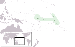
Author: User:Vardion Describtion: Location map for Kiribati
| |
This work has been released into the public domain by its author, Vardion, at the English विकिपिडिया project. This applies worldwide. In case this is not legally possible: |
File history
Click on a date/time to view the file as it appeared at that time.
| Date/Time | Thumbnail | Dimensions | छ्य्लामि | Comment | |
|---|---|---|---|---|---|
| current | १५:५१, ४ डिसेम्बर २०१० | | २४८ × १५६ (७ KB) | Beao | Transparent. |
| १५:४६, १५ अगस्ट २०१० |  | २४८ × १५६ (३ KB) | Ras67 | cropped | |
| १३:२१, ६ फेब्रुवरी २००६ |  | २५० × १५८ (३ KB) | Quadell | Switched from truecolor to palette-based encoding to losslessly shrink the file size by 53%. (This change was previously made on en-wikipedia by User:Riumplus | |
| ०६:२८, ४ अप्रिल २००५ |  | २५० × १५८ (६ KB) | Knutux | Location map for Kiribati {{CopyrightedFreeUse}} {{GFDL}} en:Image:LocationKiribati.png |
File usage
The following page uses this file:
Global file usage
The following other wikis use this file:
- Usage on af.wikipedia.org
- Usage on ar.wikipedia.org
- Usage on ban.wikipedia.org
- Usage on ba.wikipedia.org
- Usage on be.wikipedia.org
- Usage on bg.wikipedia.org
- Usage on bo.wikipedia.org
- Usage on bpy.wikipedia.org
- Usage on bs.wikipedia.org
- Usage on ca.wikipedia.org
- Usage on ceb.wikipedia.org
- Usage on chr.wikipedia.org
- Usage on ckb.wikipedia.org
- Usage on crh.wikipedia.org
- Usage on cs.wikipedia.org
- Usage on cu.wikipedia.org
- Usage on da.wikipedia.org
- Usage on de.wikipedia.org
- Usage on de.wiktionary.org
- Usage on el.wiktionary.org
- Usage on en.wikipedia.org
- Usage on en.wikivoyage.org
- Usage on es.wikipedia.org
- Usage on es.wikinews.org
- Usage on ext.wikipedia.org
- Usage on fa.wikipedia.org
- Usage on fiu-vro.wikipedia.org
- Usage on frp.wikipedia.org
- Usage on fr.wikipedia.org
- Usage on fy.wikipedia.org
- Usage on gv.wikipedia.org
- Usage on he.wikivoyage.org
- Usage on hif.wikipedia.org
- Usage on hi.wikipedia.org
- Usage on hr.wikipedia.org
View more global usage of this file.