किपा:Mesoamérica.png
Size of this preview: ८०० × ५८८ pixels. Other resolutions: ३२० × २३५ pixels | ६४० × ४७० pixels | १,०२४ × ७५२ pixels | १,०७४ × ७८९ pixels.
Original file (१,०७४ × ७८९ pixels, file size: १.१७ MB, MIME type: image/png)
Summary
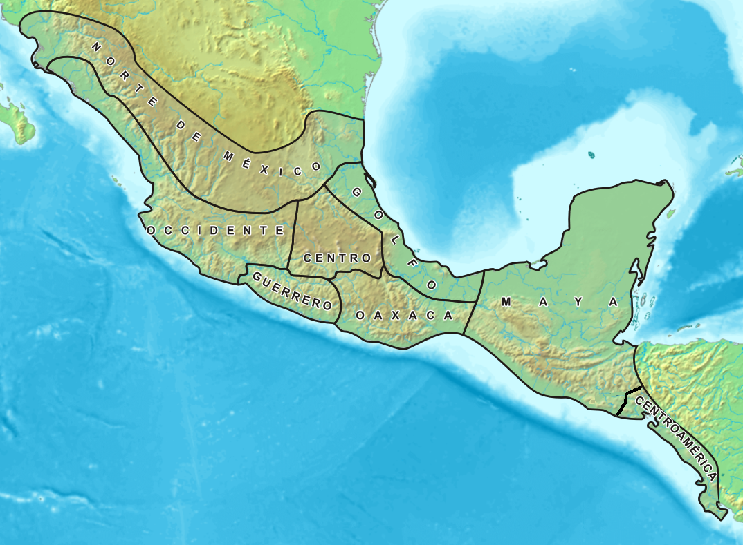
Español: Mapa de las áreas culturales de Mesoamérica. Fue elaborado por Yavidaxiu a partir de los mapas Image:Topographic30deg N0W90.png y Image:Topographic30deg N0W60.png, que obran en el archivo de Wikimedia Commons.
Licensing

|
Permission is granted to copy, distribute and/or modify this document under the terms of the GNU Free Documentation License, Version 1.2 or any later version published by the Free Software Foundation; with no Invariant Sections, no Front-Cover Texts, and no Back-Cover Texts. A copy of the license is included in the section entitled GNU Free Documentation License. |
| This file is licensed under the Creative Commons Attribution-Share Alike 3.0 Unported license. | ||
| ||
| This licensing tag was added to this file as part of the GFDL licensing update. |
File history
Click on a date/time to view the file as it appeared at that time.
| Date/Time | Thumbnail | Dimensions | छ्य्लामि | Comment | |
|---|---|---|---|---|---|
| current | ०२:१७, १५ फेब्रुवरी २००७ | | १,०७४ × ७८९ (१.१७ MB) | Juan Miguel | == Sumario == {{es|Mapa de las áreas culturales de Mesoamérica}} Mapa en el que se indican las áreas culturales de Mesoamérica. Fue elaborado por Yavidaxiu a partir de los mapas Imagen:Topographic30deg N0W90.png y Imagen:Topographic |
| ०४:४३, ४ अप्रिल २००६ |  | १,०७४ × ७८९ (१.१७ MB) | Yavidaxiu | Mapa en el que se indican las áreas culturales de Mesoamérica. Fue elaborado por Yavidaxiu a partir de los mapas Imagen:Topographic30deg N0W90.png y Imagen:Topographic30deg N0W60.png, que obran en el archivo de Wikimedia Commons. [[ |
File usage
There are no pages that use this file.
Global file usage
The following other wikis use this file:
- Usage on af.wikipedia.org
- Usage on ast.wikipedia.org
- Usage on az.wikipedia.org
- Usage on be-tarask.wikipedia.org
- Usage on be.wikipedia.org
- Usage on ca.wikipedia.org
- Usage on ce.wikipedia.org
- Usage on cs.wikipedia.org
- Usage on de.wikipedia.org
- Usage on eo.wikipedia.org
- Usage on es.wikipedia.org
- Usage on fi.wikipedia.org
- Usage on fr.wikipedia.org
- Usage on gl.wikipedia.org
- Usage on hy.wikipedia.org
- Usage on ia.wikipedia.org
- Usage on ja.wikipedia.org
- Usage on ka.wikipedia.org
- Usage on kk.wikipedia.org
- Usage on ko.wikipedia.org
- Usage on lad.wikipedia.org
- Usage on lt.wikipedia.org
- Usage on mn.wikipedia.org
- Usage on nl.wikipedia.org
- Usage on pt.wikipedia.org
- Usage on ro.wikipedia.org
- Usage on ru.wikipedia.org
- Usage on sl.wikipedia.org
- Usage on uk.wikipedia.org
- Usage on uz.wikipedia.org
- Usage on www.wikidata.org
- Usage on xmf.wikipedia.org