किपा:South Korea physical map.svg

Size of this PNG preview of this SVG file: ७६२ × ६०० pixels. Other resolutions: ३०५ × २४० pixels | ६१० × ४८० pixels | ९७६ × ७६८ pixels | १,२८० × १,००८ pixels | २,५६० × २,०१६ pixels | ८५१ × ६७० pixels.
Original file (SVG file, nominally ८५१ × ६७० pixels, file size: १.६६ MB)
Summary
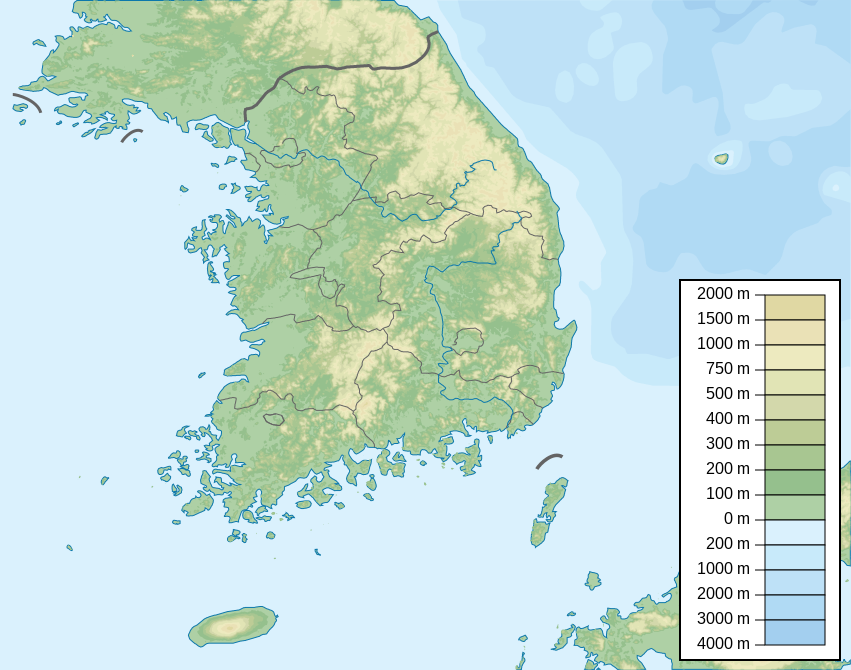
| Description | Map of South Korea, parameters equivalent to File:South Korea location map.svg |
| Date | |
| Source | Own work |
| Author | Urutseg |
| SVG genesis | This locator map was created with Inkscape. |
Licensing
I, the copyright holder of this work, hereby publish it under the following license:
| This file is made available under the Creative Commons CC0 1.0 Universal Public Domain Dedication. | |
| The person who associated a work with this deed has dedicated the work to the public domain by waiving all of their rights to the work worldwide under copyright law, including all related and neighboring rights, to the extent allowed by law. You can copy, modify, distribute and perform the work, even for commercial purposes, all without asking permission.
|
File history
Click on a date/time to view the file as it appeared at that time.
| Date/Time | Thumbnail | Dimensions | छ्य्लामि | Comment | |
|---|---|---|---|---|---|
| current | ०५:०८, ३ ज्यानुवरी २०२३ | | ८५१ × ६७० (१.६६ MB) | Antonsusi | also |
| ०५:०५, ३ ज्यानुवरी २०२३ |  | ८५१ × ६७० (१.६६ MB) | Antonsusi | validizing | |
| १६:१६, ४ जुन २०१३ |  | ८५१ × ६७० (१.६७ MB) | Garam | - Western Sea Military Demarcation Line | |
| ०४:०९, २५ जुलाई २०११ |  | ८५१ × ६७० (१.६८ MB) | Urutseg | moing legend away from Dokdo(en:Liancourt Rocks) | |
| १८:३४, १२ मार्च २०११ |  | ८५१ × ६७० (१.६८ MB) | Urutseg |
File usage
The following page uses this file:
Global file usage
The following other wikis use this file:
- Usage on arz.wikipedia.org
- Usage on ast.wikipedia.org
- Usage on azb.wikipedia.org
- Usage on ban.wikipedia.org
- Usage on ba.wikipedia.org
- Usage on be.wikipedia.org
- Usage on bn.wikipedia.org
- Usage on ca.wikipedia.org
- Usage on ceb.wikipedia.org
- Usage on ce.wikipedia.org
- Usage on ckb.wikipedia.org
- Usage on cs.wikipedia.org
- Usage on da.wikipedia.org
- Usage on de.wikipedia.org
- Usage on de.wikivoyage.org
View more global usage of this file.