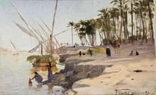
नाइल खुसि
नाइल खुसि हलिमया दक्ले ताःहाकगु खुसि ख।
| Nile | |
| River | |
The Nile's watershed
| |
| Countries | Ethiopia, Sudan, Egypt, Uganda, Democratic Republic of the Congo, Kenya, Tanzania, Rwanda, Burundi, South Sudan |
|---|---|
| Cities | Jinja, Juba, Khartoum, Cairo |
| Primary source | White Nile |
| - elevation | २,७०० m (८,८५८ ft) |
| - coordinates | 02°16′56″S 029°19′53″E / 2.28222°S 29.33139°E |
| Secondary source | Blue Nile |
| - location | Lake Tana, Ethiopia |
| - coordinates | 12°02′09″N 037°15′53″E / 12.03583°N 37.26472°E |
| Source confluence | near Khartoum |
| Mouth | |
| - location | Mediterranean Sea |
| - elevation | ० m (० ft) |
| - coordinates | 30°10′N 031°06′E / 30.167°N 31.100°E [१] |
| Length | ६,६५० km (४,१३२ mi) |
| Width | २.८ km (२ mi) |
| Basin | ३,४००,००० km² (१,३१२,७४७ sq mi) |
| Discharge | |
| - average | २,८३० m³/s (९९,९४१ cu ft/s) |
| [२] | |

स्वयादिसँ सम्पादन
| विकिमिडिया मंका य् थ्व विषय नाप स्वापु दुगु मिडिया दु: Nile |
- ↑ Template:GEOnet2
- ↑ The Nile River. Nile Basin Initiative (2011). 1 February 2011 कथं।
