लुइजियानाया प्यारिशतेगु धलः
संयुक्त राज्य अमेरिकाया राज्यय् राज्ययात थीथी काउन्तिइ विभाजित यानातःगु दु। लुइजियानाय् धाःसा राज्ययात थीथी प्यारिशय् विभक्त यानातःगु दु। थ्व राज्यया प्यारिश थ्व कथं दु-
| अंग्रेजीइ नां [१] |
प्यारिश (Parish) |
FIPS कोड [१] |
प्यारिशया मुख्यालय [२] |
पलिस्था [२] |
उत्पत्ति |
नामाकरण [३] |
जनसंख्या [२] |
क्षेत्रफल [२] |
मानकिपा
|
|---|---|---|---|---|---|---|---|---|---|
| Acadia | अकेदिया Parish | 001 | क्राउलि | 1886 | from part of St. Landry Parish. | Named for the Acadians who settled the area. | ६१,७७३ | ६५८ sq mi (१,७०४ km2) |

|
| Allen | एलेन Parish | 003 | Oberlin | 1912 | from part of Calcasieu Parish. | Henry Watkins Allen, the Confederate governor of Louisiana | २५,७६४ | ७६६ sq mi (१,९८४ km2) |

|
| Ascension | एसेन्सन (Ascension) Parish | 005 | दोनाल्दसन्भिल | 1807 | One of the original 19 parishes. | Named for the Ascension of Our Lord Catholic Church in Donaldsonville, Louisiana, which was named after the Ascension of Jesus into Heaven | १०७,२१५ | ३०३ sq mi (७८५ km2) |

|
| Assumption | एजम्प्सन Parish | 007 | नेपोलियनभिल | 1807 | One of the original 19 parishes. | Named for the Assumption Roman Catholic Church, the oldest in the state, which was named after the Assumption of the Virgin Mary | २३,४२१ | ३६४ sq mi (९४३ km2) |

|
| Avoyelles | Avoyelles Parish | 009 | मार्क्सभिल | 1807 | One of the original 19 parishes. | The Avoyel Native American people | ४२,०७३ | ८६६ sq mi (२,२४३ km2) |

|
| Beauregard | Beauregard Parish | 011 | DeRidder | 1912 | from part of Calcasieu Parish. | Confederate general P. G. T. Beauregard | ३५,६५४ | १,१६६ sq mi (३,०२० km2) |

|
| Bienville | बियनभिल Parish | 013 | आर्केदिया | 1848 | from part of Claiborne Parish. | Named after the founder of the city of New Orleans, Jean-Baptiste Le Moyne de Bienville | १४,३५३ | ८२२ sq mi (२,१२९ km2) |

|
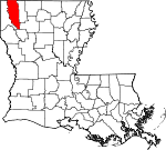
| Bossier | बोसियर Parish | 015 | बेन्तन | 1843 | from part Claiborne Parish. | U.S. Representative Pierre Bossier | ११६,९७९ | ८६७ sq mi (२,२४६ km2) |
|
| Caddo | क्यादो Parish | 017 | श्रिभ्पोर्त | 1838 | from part of Natchitoches Parish. | Named for the Caddo Native American people | २५४,९६९ | ९३७ sq mi (२,४२७ km2) |

|
| Calcasieu | Calcasieu Parish | 019 | लेक चार्ल्स | 1840 | from part of St. Landry Parish. | Calcasieu, meaning crying eagle, is said to be the name of an Atakapa Native American leader | १९२,७६८ | १,०९४ sq mi (२,८३३ km2) |

|
| Caldwell | काल्दवेल Parish | 021 | कोलम्बिया | 1838 | from part of Catahoula Parish and Ouachita Parish. | Named for the Caldwell family, which owned a large plantation and remains politically active in the state. | १०,१३२ | ५४१ sq mi (१,४०१ km2) |

|
| Cameron | क्यामेरन Parish | 023 | क्यामेरन | 1870 | from parts of Calcasieu Parish and Vermilion Parish. | U.S. Secretary of War Simon Cameron | ६,८३९ | १,९३२ sq mi (५,००४ km2) |

|
| Catahoula | Catahoula Parish | 025 | ह्यारिसनबर्ग | 1808 | from parts of Ouachita Parish and Rapides Parish. | Catahoula Lake, formerly within the parish's boundaries and named from a Taensa word meaning big, clear lake | १०,४०७ | ७३९ sq mi (१,९१४ km2) |

|
| Claiborne | क्लेबर्न Parish | 027 | होमर | 1828 | from part of Natchitoches Parish. | Governor of Louisiana William C. C. Claiborne | १७,१९५ | ७६८ sq mi (१,९८९ km2) |

|
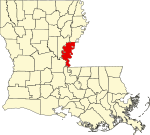
| Concordia | कंकर्दिया Parish | 029 | Vidalia | 1807 | One of the original 19 parishes. | Name is of uncertain origin; may be from an early land grant called New Concordia, from the "concord" reached by local authorities over a mutual surrender of slaves or for a mansion called Concord which was owned by Spanish Governor Manuel Gayoso de Lemos | २०,८२२ | ७४९ sq mi (१,९४० km2) |
|
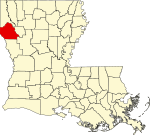
| De Soto | दे सोतो Parish | 031 | म्यान्स्फिल्द | 1843 | from parts of Caddo Parish and Natchitoches Parish. | Spanish explorer Hernando de Soto | २६,६५६ | ८९५ sq mi (२,३१८ km2) |
|
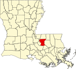
| East Baton Rouge | इस्त ब्यातन रुज Parish | 033 | ब्यातन रुज | 1810 | from West Florida territory. | French phrase bâton rouge meaning red stick. A red stick was used by local Native Americans to mark the boundaries between tribal territories | ४४०,१७१ | ४७१ sq mi (१,२२० km2) |
|
| East Carroll | इस्त क्यारल Parish | 035 | लेक प्रोभिदेन्स | 1877 | when Carroll Parish was divided. | Charles Carroll of Carrollton, the last surviving signer of the U.S. Declaration of Independence | ७,७५९ | ४४२ sq mi (१,१४५ km2) |

|
| East Feliciana | East Feliciana Parish | 037 | Clinton | 1824 | when Feliciana Parish was divided. | Felicite de Gálvez, the wife of Bernardo de Gálvez, a Spanish governor of Louisiana (New Spain) | २०,२६७ | ४५६ sq mi (१,१८१ km2) |

|
| Evangeline | इभ्याञ्जेलिन Parish | 039 | Ville Platte | 1910 | from part of St. Landry Parish. | Acadian heroine of the poem "Evangeline" by Henry Wadsworth Longfellow | ३३,९८४ | ६८० sq mi (१,७६१ km2) |

|
| Franklin | फ्र्याङ्क्लिन Parish | 041 | विन्सबोरो | 1843 | from parts of Carroll Parish, Catahoula Parish, Madison Parish and Ouachita Parish | Founding Father Benjamin Franklin | २०,७६७ | ६३६ sq mi (१,६४७ km2) |

|
| Grant | ग्रान्त Parish | 043 | कोल्फ्याक्स | 1869 | from parts of Rapides Parish and Winn Parish. | U.S. President Ulysses S. Grant | २२,३०९ | ६६४ sq mi (१,७२० km2) |

|
| Iberia | आइबेरिया Parish | 045 | न्यु आइबेरिया | 1868 | from parts of St. Martin Parish and St. Mary Parish. | Named by Spanish settlers in honor of the Iberian Peninsula | ७३,२४० | १,०३१ sq mi (२,६७० km2) |

|
| Iberville | आइबरभिल Parish | 047 | Plaquemine | 1807 | One of the original 19 parishes. | Explorer Pierre Le Moyne d'Iberville, the brother of Jean-Baptiste Le Moyne de Bienville | ३३,३८७ | ६५३ sq mi (१,६९१ km2) |

|
| Jackson | ज्याक्सन Parish | 049 | जोनेस्बरो | 1845 | from parts of Claiborne Parish, Ouachita Parish and Union Parish | U.S. President Andrew Jackson | १६,२७४ | ५८० sq mi (१,५०२ km2) |

|
| Jefferson | जेफर्सन Parish | 051 | ग्रेत्ना | 1825 | from part of Orleans Parish | Founding Father Thomas Jefferson | ४३२,५५२ | ६४२ sq mi (१,६६३ km2) |

|
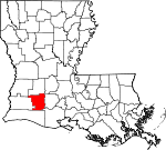
| Jefferson Davis | जेफर्सन देविस Parish | 053 | जेनिङ्ग्स् | 1912 | from part of Calcasieu Parish. | Jefferson Davis, president of the Confederate States of America | ३१,५९४ | ६५९ sq mi (१,७०७ km2) |
|
| Lafayette | लाफायेत Parish | 055 | लाफायेत | 1823 | from part of St. Martin Parish. | French-born American Revolutionary War hero, the Marquis de Lafayette | २२१,५७८ | २७० sq mi (६९९ km2) |

|
| Lafourche | Lafourche Parish | 057 | Thibodaux | 1807 | One of the original 19 parishes. Was named Interior Parish until 1812 and Lafourche Interior Parish until 1853. | French phrase la fourche or in English, the fork; Bayou Lafourche, or Fork Bayou, is a fork of the Mississippi River | ९६,३१८ | १,४७२ sq mi (३,८१२ km2) |

|
| La Salle | ला साल Parish | 059 | जेना | 1910 | from west half of Catahoula Parish. | Explorer René-Robert Cavelier, Sieur de La Salle | १४,८९० | ६६३ sq mi (१,७१७ km2) |

|
| Lincoln | लिङ्कन Parish | 061 | रस्तन | 1873 | from parts of Bienville Parish, Claiborne Parish, Jackson Parish and Union Parish. | U.S. President Abraham Lincoln | ४६,७३५ | ४७२ sq mi (१,२२२ km2) |

|
| Livingston | लिभिङ्गस्तन् Parish | 063 | लिभिङ्गस्तन् | 1832 | from part of St. Helena Parish. | U.S. Secretary of State Edward Livingston, brother of Robert R. Livingston who negotiated the Louisiana Purchase | १२८,०२६ | ७०३ sq mi (१,८२१ km2) |

|
| Madison | म्यादिसन Parish | 065 | तालुला | 1838 | from Concordia Parish. | U.S. President James Madison | १२,०९३ | ६५१ sq mi (१,६८६ km2) |

|
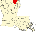
| Morehouse | मोरहाउस Parish | 067 | ब्यास्त्रप | 1844 | from parts of Carroll Parish and Ouachita Parish. | Abraham Morehouse, who led the first settlers into the region | २७,९७९ | ८०५ sq mi (२,०८५ km2) |
|
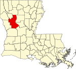
| Natchitoches | न्याकितोस् Parish | 069 | न्याकितोस् | 1807 | One of the original 19 parishes. | The Natchitoches Native American people | ३९,५६६ | १,२९९ sq mi (३,३६४ km2) |
|
| Orleans | अर्लिन्स Parish | 071 | न्यु अर्लिन्स | 1807 | One of the original 19 parishes. Today coterminous with the City of New Orleans. | Named after the Duke of Orléans, the regent of France | ३४३,८२९ | ३५० sq mi (९०६ km2) |

|
| Ouachita | वाशिता Parish | 073 | मन्रो | 1807 | One of the original 19 parishes. | The Ouachita Native American people | १५३,७२० | ६३३ sq mi (१,६३९ km2) |

|
| Plaquemines | Plaquemines Parish | 075 | Pointe a la Hache | 1807 | One of the original 19 parishes. | A word meaning persimmons created from the Louisiana Creole French and the Atakapa language | २३,०४२ | २,४२९ sq mi (६,२९१ km2) |

|
| Pointe Coupee | Pointe Coupee Parish | 077 | न्यु रोद्स् | 1807 | One of the original 19 parishes. | French phrase la pointe coupée or in English, the cut-off point, which refers to a bend in the Mississippi River | २२,८०२ | ५९१ sq mi (१,५३१ km2) |

|
| Rapides | Rapides Parish | 079 | अलेक्ज्यान्द्रिया | 1807 | One of the original 19 parishes. | Named for local river rapids (French: rapides) | १३१,६१३ | १,३६२ sq mi (३,५२८ km2) |

|
| Red River | रेद रिभर Parish | 081 | Coushatta | 1871 | from parts of Bienville Parish, Bossier Parish, Caddo Parish and Natchitoches Parish. | Named for the Red River, which is part of the Mississippi River watershed | ९,०९१ | ४०२ sq mi (१,०४१ km2) |

|
| Richland | रिचल्यान्द Parish | 083 | रेभिल | 1868 | from parts of Carroll Parish, Franklin Parish, Morehouse Parish and Ouachita Parish. | Named for its rich land | २०,७२५ | ५६४ sq mi (१,४६१ km2) |

|
| Sabine | Sabine Parish | 085 | Many | 1843 | from parts of Caddo Parish and Natchitoches Parish. | Named for the Sabine River and the so-called Sabine Free State | २४,२३३ | १,०१२ sq mi (२,६२१ km2) |

|
| Saint Bernard | सेन्त बर्नार्द Parish | 087 | Chalmette | 1807 | One of the original 19 parishes. | Saint Bernard, patron saint of Bernardo de Galvez, the Spanish governor who granted land to the Canary Islanders settling the area in 1778 | ३५,८९७ | १,७९४ sq mi (४,६४६ km2) |

|
| Saint Charles | सेन्त चार्ल्स Parish | 089 | Hahnville | 1807 | One of the original 19 parishes. | Saint Charles | ५२,७८० | ४१० sq mi (१,०६२ km2) |

|
| Saint Helena | सेन्त हेलेना Parish | 091 | ग्रीन्सबर्ग | 1810 | from West Florida territory. | Saint Helena | ११,२०३ | ४०९ sq mi (१,०५९ km2) |

|
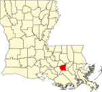
| Saint James | सेन्त जेम्स Parish | 093 | कन्भेन्त | 1807 | One of the original 19 parishes. | Saint James | २२,१०२ | २५८ sq mi (६६८ km2) |
|
| Saint John the Baptist | सेन्त जन द ब्याप्तिस्त Parish | 095 | एद्गार्द | 1807 | One of the original 19 parishes. | Saint John the Baptist | ४५,९२४ | ३४८ sq mi (९०१ km2) |

|
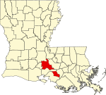
| Saint Landry | Saint Landry Parish | 097 | Opelousas | 1807 | One of the original 19 parishes. | Saint Landry | ८३,३८४ | ९३९ sq mi (२,४३२ km2) |

|
| Saint Martin | सेन्त मार्तिन Parish | 099 | Saint मार्तिनभिल | 1807 | One of the original 19 parishes. | Saint Martin | ५२,१६० | ८१७ sq mi (२,११६ km2) |
|
| Saint Mary | सेन्त मेरी Parish | 101 | फ्र्याङ्क्लिन | 1811 | from part of St. Martin Parish. | Saint Mary. | ५४,६५० | ६१२ sq mi (१,५८५ km2) |

|
| Saint Tammany | Saint Tammany Parish | 103 | कभिङ्तन | 1810 | from West Florida territory. | Legendary Indian Chief Tamanend. | २३३,७४० | १,१२४ sq mi (२,९११ km2) |

|
| Tangipahoa | Tangipahoa Parish | 105 | Amite | 1869 | from parts of Livingston Parish, St. Helena Parish, St. Tammany Parish and Washington Parish. | Comes from an Acolapissa word meaning ear of corn or those who gather corn | १२१,०९७ | ८२३ sq mi (२,१३२ km2) |

|
| Tensas | Tensas Parish | 107 | सेन्त जोसेफ | 1843 | from part of Concordia Parish. | The Taensa Native American people. | ५,०६६ | ६४१ sq mi (१,६६० km2) |

|
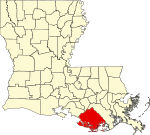
| Terrebonne | Terrebonne Parish | 109 | होमा | 1822 | from part of Lafourche Interior Parish. | French phrase terre bonne or in English, good earth | १११,८६० | २,०८० sq mi (५,३८७ km2) |
|
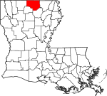
| Union | युनियन Parish | 111 | फार्मरभिल | 1839 | from part of Ouachita Parish. | Named for the union of states which make up the U.S. | २२,७२१ | ९०५ sq mi (२,३४४ km2) |
|
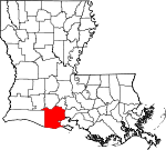
| Vermilion | Vermilion Parish | 113 | Abbeville | 1844 | from part of Lafayette Parish. | Both the Vermilion River and Vermilion Bay | ५७,९९९ | १,५३८ sq mi (३,९८३ km2) |
|
| Vernon | Vernon Parish | 115 | Leesville | 1871 | from parts of Natchitoches Parish, Rapides Parish and Sabine Parish. | Mount Vernon, the home of George Washington, the first U.S. President | ५२,३३४ | १,३४१ sq mi (३,४७३ km2) |

|
| Washington | वाशिङ्गतन Parish | 117 | फ्र्याङ्क्लिनतन | 1819 | from part of St. Tammany Parish. | U.S. President George Washington | ४७,१६८ | ६७६ sq mi (१,७५१ km2) |

|
| Webster | वेब्स्तर Parish | 119 | मिन्देन | 1871 | from parts of Bienville Parish, Bossier Parish and Claiborne Parish. | U.S. statesman Daniel Webster | ४१,२०७ | ६१५ sq mi (१,५९३ km2) |

|
| West Baton Rouge | वेस्त ब्यातन रुज Parish | 121 | पोर्त एलेन | 1807 | One of the original 19 parishes. Was named Baton Rouge Parish until 1812. | French phrase bâton rouge meaning red stick. A red stick was used by local Native Americans to mark the boundaries between tribal territories | २३,७८८ | २०३ sq mi (५२६ km2) |

|
| West Carroll | वेस्त क्यारल Parish | 123 | ओक ग्रोभ, वेस्त क्यारल प्यारिश | 1877 | when Carroll Parish was divided. | Charles Carroll of Carrollton, the last surviving signer of the U.S. Declaration of Independence | ११,६०४ | ३६० sq mi (९३२ km2) |

|
| West Feliciana | वेस्त फेलिसियाना Parish | 125 | सेन्त फ्रान्सिसभिल | 1824 | when Feliciana Parish was divided. | Felicite de Gálvez, the wife of Bernardo de Gálvez, a Spanish governor of Louisiana (New Spain) | १५,६२५ | १,०५१ sq mi (२,७२२ km2) |

|
| Winn | विन Parish | 127 | विनफिल्द | 1852 | from parts of Catahoula Parish, Natchitoches Parish and Rapides Parish. | Louisiana state legislator Walter Winn | १५,३१३ | ९५७ sq mi (२,४७९ km2) |

|
- ↑ EPA County FIPS Code Listing. EPA.gov. 2008-02-23 कथं।
- ↑ २.० २.१ २.२ २.३ National Association of Counties. NACo - Find a county. मूलिधंसाय् तिथि 2008-06-04 कथं। 2008-06-12 कथं।
- ↑ Louisiana Dept. of Public Health Parish Profiles